
Bathymetry at the Cromer Chalk Beds
The Cromer Shoal Chalk Bed is one of Norfolk’s most impressive natural features. Covering an area larger than the Broads National Park, this 100-million-year-old habitat provides a haven for a diverse range of species, including sponges, anemones and the famous Cromer Crab. This vast array of marine flora and fauna led to the designation of the chalk bed as a Marine Conservation Zone (MCZ) in 2016.
The area supports a traditional crab and lobster potting fishery which has played a vital role in the surrounding coastal communities for centuries, tracing back as far as eight generations with certain families in Cromer.
However, the anthropogenic effects on chalk habitats are unavoidable, and, as a result, the Eastern Inshore Fisheries and Conservation Authority (EIFCA) has been carrying out multiple studies to assess these impacts and develop mitigation strategies to manage them in the future.
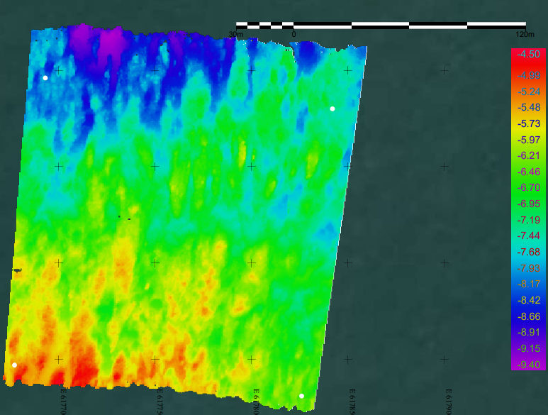
Mapped Bathymetric Data from off the shore of Cromer. 2025
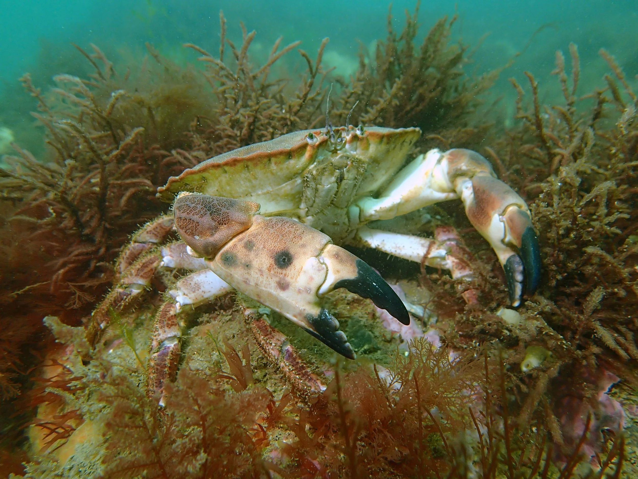
A ‘Cromer Crab’ a local species of Brown Crab (Cancer Pagurus) as pictured on the Cromer Shoal Chalk Beds. (Credit to Sea Search East for Photo)
As part of these studies Exo Environmental were contracted to carry out a series of multibeam bathymetry surveys of particular areas within the MCZ, from May 2024 to September 2025.
These surveys were carried out from EIFCA’s vessel, FPV Sebastian Terelinck, based in Lowestoft. The surveys involved a transit of approximately 1hr 20mins from Lowestoft to the survey sites, where upon arrival, equipment set up took place.
Exo utilised a Norbit IWBMS multibeam system for these surveys. This system is a high-end sonar with globally leading GNSS/Inertial Navigation System (Applanix WaveMaster II) embedded into the unit which ensures fast and reliable mobilization and highest quality soundings for most conditions and exceeds IHO Special Order, CHS Exclusive Order & USACE New Work.
Once the equipment was set up a heading alignment and patch test was performed in order to calibrate the GPS antennas for cm accurate positioning.
Once completed the survey was started, collecting both raw bathymetric data of the target sites and also backscatter data. Each survey took approximately 3 hours to complete. Once back on shore the data was processed by our in-house hydrographic surveyors and the data sent in multiple formats to EIFCA to help inform them of any changes occurring to the survey sites.
If you would like to find out more about our Bathymetry surveys or any of our other services, please get in contact.