
Peatland Surveys, Ouse Washes Landscape Recovery 2025
Though famed today as being the ‘breadbasket’ of the UK, the Fens was once a vast area of wild wetland, gradually flooded during the end of the last Ice Age between 100,000 and 10,000 years ago.
These rising sea levels enveloped large swathes of woodland, which disrupted the normal process of vegetation decay and instead caused the formation of large amounts of peat.
That ‘breadbasket’ moniker has only arisen in the last few centuries thanks to the drainage of the Fens during the 16th century by Dutch engineer Cornelius Vermuyden. Although this drainage provided Britain with a vital increase in its food production capacity, it has also given rise to numerous negative ecological impacts, namely the loss of wetland biodiversity and the increase in carbon emissions from the exposure and subsequent oxidisation of peat.
However, in recent years, there have been a number of different Fenland restoration projects.
One such project is the Ouse Washes Landscape Recovery – a DEFRA-funded collaboration of environmental NGOs, green finance companies and private landowners to simultaneously restore lost habitats whilst protecting local farmers’ livelihoods within the washlands in the North of the Fens.
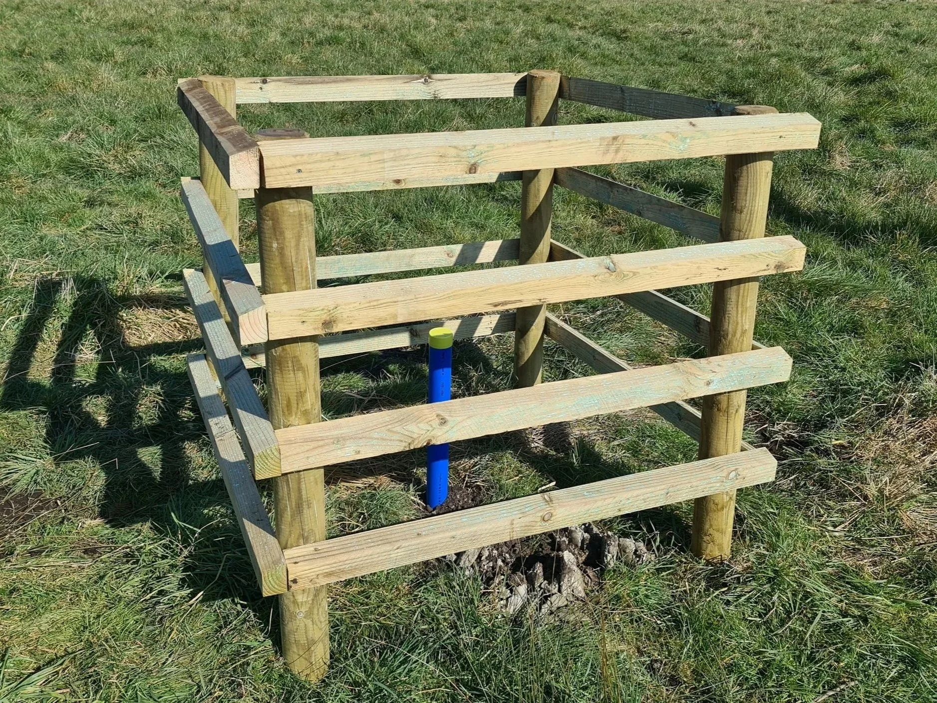
As part of this project, Exo Environmental were contracted by the RSPB in 2025 to install dipwells and carry out peat surveys at a number of arable and livestock sites that could potentially be restored to their natural peatland habitats.
Our work began in the spring with the dipwells. These are simply metre-long plastic tubes that are placed within the ground to easily allow for the measurement of the water table depth. If a peatland is to be restored, the water table needs to remain at a high level to ensure rewetting, which then will allow for the reestablishment of wetland plants and prevent further humification of peaty soils.
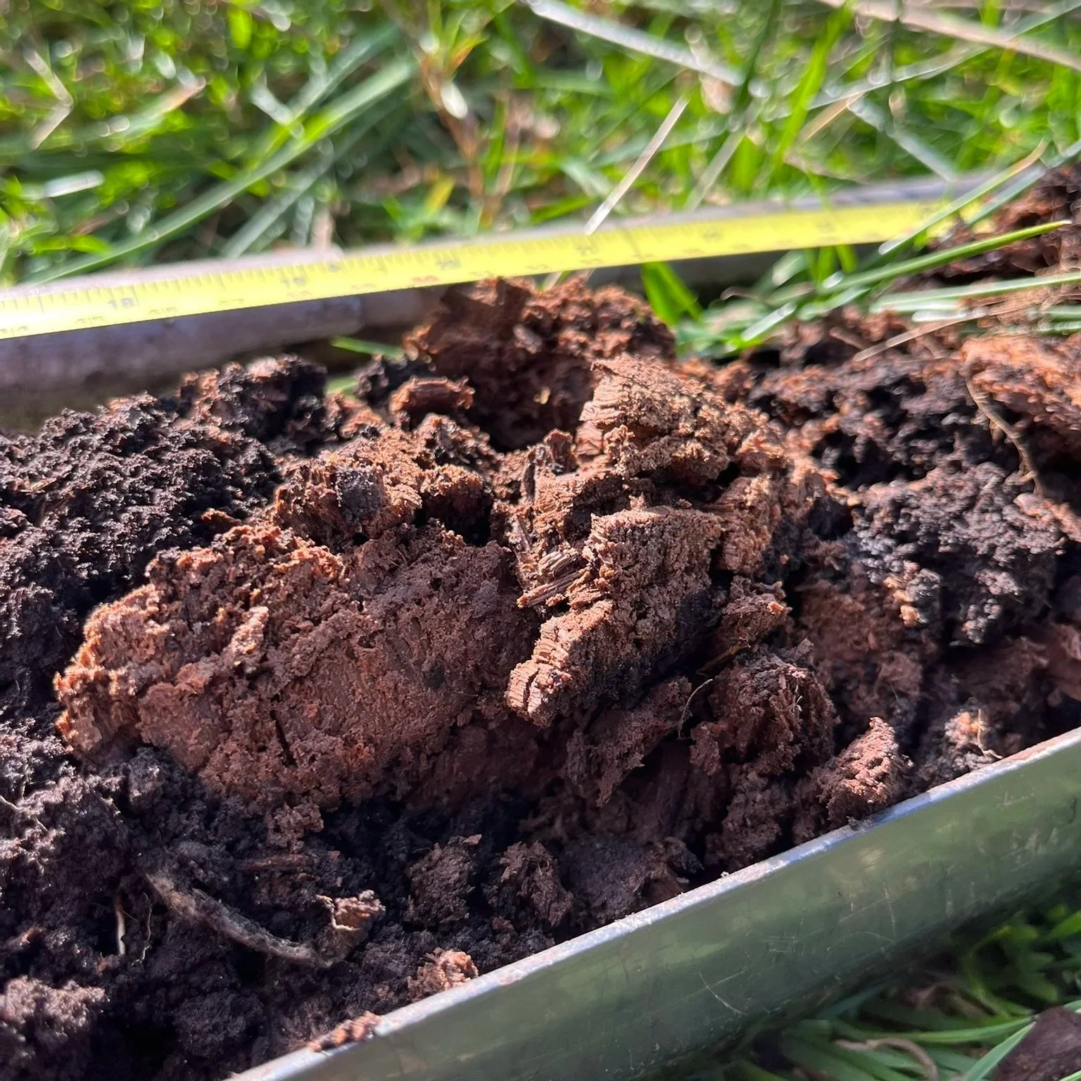
However, a consistent water table is no good if there isn’t any peat there in the first place! That’s why we returned to these sites in the autumn to carry out a full peat survey.
This followed peatland code methodology of coring to a metre deep at a 100x100m grid, classifying the soil as we go and using the Von Post scale to categorise any peat found.
This work was split over a number of weeks as the large hectarage of all these sites together meant 400 cores were required, which our team endeavoured to complete over a period of 2 months.
The consistency and prevalence of peat varied widely between sites. Some land was largely dominated by clay or sand-based mineral soils, whilst other places contained huge swathes of peat, some of which could be classified as highly as fibric H1.
As always, all the data collected has been processed and compiled into a final report so that the next steps for the Ouse Washes project can be identified.
If you would like to find out more about the peatland and soil surveys we offer, please get in touch.