
Peatland Surveys

Peatland surveys are a vital part of the Peatland Code: a voluntary certification standard for UK peatland projects wishing to market the climate benefits of peatland restoration.
The Peatland Code is the only UK Government-backed standard way to measure, validate and verify peatland carbon units in the UK. If you are a landowner, Exo Environmental can conduct peatland surveys which can determine peat coverage. This will ensure that the peat present is of eligible depth and confirm the pre-restoration (baseline) peatland condition, ultimately determining eligibility for the Peatland Code.
Here at Exo Environmental, we have extensive experience in conducting peat cores and other surveys associated with peatland restoration. We have conducted peatland surveys across numerous peatland areas for the Fens East Peatland Partnership (FEPP) project, as well as on behalf of Natural England, the Broads Authority and various wildlife trusts.
Exo also conduct additional surveys relating to peatland restoration, including topographic assessments, water table and water quality investigations.
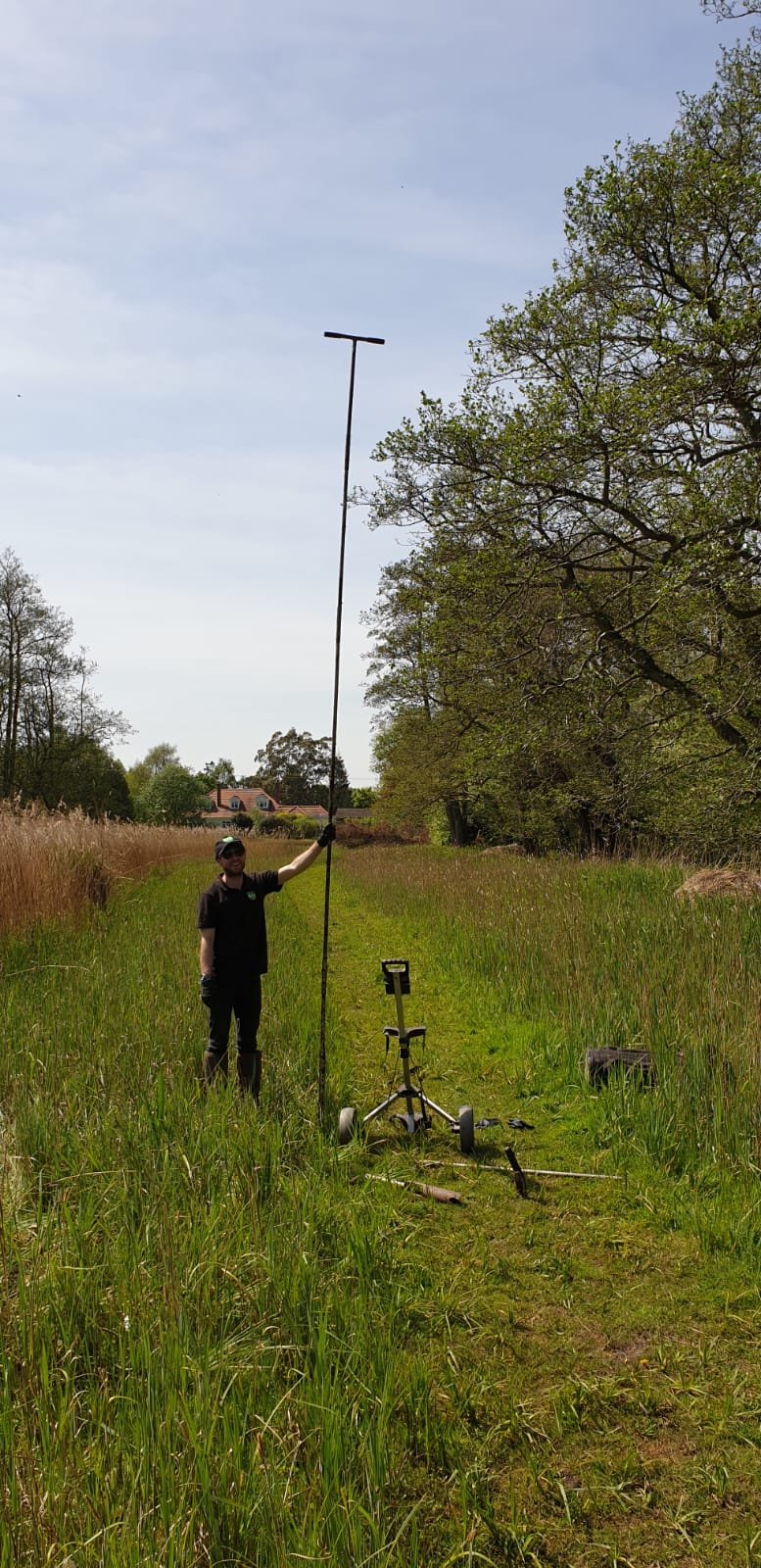

While most of our analysis is conducted in the field, we can make use of laboratory testing to identify the total organic content of soil. Other parameters can also be determined such as carbon content and particle size distribution.
Case Studies
-
In 2025, Exo were contracted by the RSPB to install dipwells and carry out peat surveys at a number of arable and livestock sites that could potentially be restored to their natural peatland habitats, as part of the wider Ouse Washes Landscape Recovery project.
Our work began in the spring with the dipwells. These are simply metre-long plastic tubes that are placed within the ground to easily allow for the measurement of the water table depth. If a peatland is to be restored, the water table needs to remain at a high level to ensure rewetting, which then will allow for the reestablishment of wetland plants and prevent further humification of peaty soils.
We then returned to these sites in the autumn to carry out a full peat survey. This followed peatland code methodology of coring to a metre deep at a 100x100m grid, classifying the soil as we go and using the Von Post scale to categorise any peat found. This work was split over a number of weeks as the large hectarage of all these sites together meant 400 cores were required, which our team endeavoured to complete over a period of 2 months.
The consistency and prevalence of peat varied widely between sites. Some land was largely dominated by clay or sand-based mineral soils, whilst other places contained huge swathes of peat, some of which could be classified as highly as fibric H1.
All the data collected has been processed and compiled into a final report so that the next steps for the Ouse Washes project can be identified.
-
Starting in 2023, Exo Environmental have carried out a number of peatland surveys in the Humberhead Levels on behalf of Yorkshire Wildlife Trust (YWT). This 2000km2 national character area was once totally covered by the Glacial Lake Humber during the last ice age, which provided the perfect conditions for the creation and preservation of peat. However, a large portion of this peat has slowly been degrading over time due to increasing human activities.
These surveys were undertaken to assess the quantity and quality of the peat present in order to determine whether or not the YWT’s sites were eligible for restoration grants in accordance with the Peatland Code.
Each survey followed a similar methodology. After determining the sample locations using GIS, and getting the go-ahead from YWT, the team headed up north to carry out the fieldwork. The soil at each sampling point was then extracted using a hand corer, Coring to 60cm if no peat was present, continuing to core down to 100cm if peat was present, and using a peat probe if peat extended beyond a metre deep. The prevalence and quality of peat fluctuated greatly between sites. Some contained very little, whilst others had deposits stretching as deep as 4.2 metres and some was even classified as H1 on the Von Post scale – the highest quality possible. In total, we conducted over 800 cores across four surveys!
After each survey, the data was processed and compiled into a final report to help YWT assess the sites suitability for peatland restoration funding.
-
In late 2024, Exo Environmental conducted a peatland survey on behalf of Forestry England at Pye House Farm near Brigg in North Lincolnshire. This site was originally an arable farm but has since been purchased by Forestry England who hoped to plant trees on the land.
However, before the vital project get underway, it was important to check if there was any peat present at the site which could be negatively impacted by the tree planting process. Forestry England then reached out to Exo Environmental to conduct a peatland survey.
Like any peatland survey, we first plotted the sampling points using GIS before heading up north begin the survey. At each location 1 metre of soil was extracted, with soil horizons recorded following Natural England guidance, including peat classification according to the Von Post scale.
From the 86 cores undertaken, only a small quantity of peat was found, and so Forestry England were able to proceed with their project.